
95 Express Lanes
Arlington, Fairfax, Prince William, Spotsylvania, and Stafford Counties, Virginia
Owner: Virginia Department of Transportation

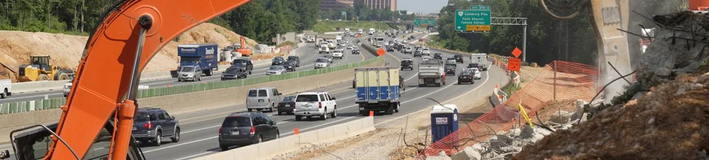
Approximately 56 miles in length, the I-95/395 project provide additional traffic lanes to relieve congestion along Interstates 95 and 395 from the Jefferson Davis Highway interchange in Arlington County extending south to Spotsylvania County. WSSI performed the delineation and survey-location of wetlands and other Waters of the U.S. (WOUS). During the delineation fieldwork, WSSI conducted 68 perennial flow determinations (to assess whether the streams were ephemeral, intermittent, or perennial) and assessed approximately 35,000 linear feet of stream using the U.S. Army Corps of Engineers’ (COE’s) and the Virginia Department of Environmental Quality’s (DEQ’s) Unified Stream Methodology. WSSI also evaluated the entire corridor for the presence of several endangered species that could occur in the project area: small whorled pogonia, harperella, and American ginseng; and evaluated the project’s potential for interaction with five other endangered species: dwarf wedgemussel, sensitive joint vetch, shortnose sturgeon, swamp pink, and bald eagle.
Thunderbird Archeology, a division of WSSI, conducted a Phase I archeological investigation of the project site. Twenty-one previously-recorded archeological sites and two historic resources are either wholly or partially located within the APE for this project; fifteen of the previously-recorded archeological sites had been destroyed. Sixteen new archeological sites were recorded during this survey.
WSSI obtained the necessary permits (from the COE, DEQ, and Virginia Marine Resources Commission) for the impacts to wetlands and other WOUS. As part of this process, WSSI conducted a functions and values assessment of approximately 50 different wetland systems along the entire study area, utilizing The Highway Methodology Workbook Supplement, Wetlands Functions and Values, A Descriptive Approach, published by the New England District of the COE. This method was devised to characterize wetland functions and values specifically for highway projects and is a supplement to The Highway Methodology Workbook, published by the COE to integrate Section 404 permit requirements with highway planning and engineering and the National Environmental Policy Act.
WSSI also evaluated the potential stream and wetland mitigation requirements and devised scenarios to provide compensation when appropriate, including the design and approval (COE, DEQ, and Prince William County) for the restoration of 1,435 linear feet of Swan's Creek in Prince William County. WSSI continues to conduct post-restoration monitoring of stream conditions and health.